Chiricahua National Monument
Chiricahua National Monument is a national monument run by the National Park Service in Cochise County, Arizona. There is no entrance fee. It is open 24 hours a day, year-round. It has 1 developed campground, from $25 a night.
Check current closures and fire restrictions for Chiricahua National Monument on the managing agency's own page.
Chiricahua National Monument map
Chiricahua National Monument boundary from USGS PAD-US or the managing agency, simplified for display. Not for navigation or legal boundaries.
Fire restrictions
No fire restriction recorded for this unit as of Sept. 30, 2026. Restrictions change with the season, so check the current orders below before you go.
Common questions
- Yes. Chiricahua National Monument has no entrance fee.
- Yes. Chiricahua National Monument is open 24 hours a day, year-round.
- Yes. Chiricahua National Monument has 1 developed campground with 23 sites. Sites cost $25 to $50 a night. Campsites must be reserved ahead. Each site holds up to 8 people. No hookups; no showers.
Fees, passes, and hours
Chiricahua National Monument has no entrance fee.
Chiricahua National Monument is open 24 hours a day, year-round.
Sources: nps.gov/chir/planyourvisit/fees, checked 2026-09-29; nps.gov/chir/planyourvisit/hours, checked 2026-09-29.
Entrances and visitor centers
- Chiricahua National Monument Visitor CenterVisitor center, year-round: 8:30 a.m. to 4:30 p.m.13063 E Bonita Canyon Rd, Willcox, AZ 85643520-824-3560
Source: nps.gov/chir/planyourvisit/hours, checked 2026-09-29.
Camping in Chiricahua National Monument
Chiricahua National Monument has 1 developed campground with 23 sites. Sites cost $25 to $50 a night. Campsites must be reserved ahead. Each site holds up to 8 people. No hookups; no showers.
Campfires: No ground fires; standup grills only with charcoal or pest-free firewood.
Source: nps.gov/chir/planyourvisit/bonita-canyon-campground, checked 2026-09-29.
Pets
They are allowed on trails.
Source: nps.gov/chir/planyourvisit/pets, checked 2026-09-28.
Scenic drives
- Bonita Canyon Scenic Drive8 mi, paved, vehicles over 24 ft not allowed on part of it
Source: nps.gov/chir/planyourvisit/scenic-drive, checked 2026-09-29.
Getting there
- Nearest town: Willcox, AZ
- Nearest fuel: 30 miles
- No public transit to the park.
- Limited cell service
Source: nps.gov/chir/planyourvisit/scenic-drive, checked 2026-09-29.
Trails
- Massai Point Nature TrailInterpretive loop at Massai Point; north segment paved to an exhibit building.
- Bonita Creek LoopAccessible paved trail through grassland; good birding.
- Echo Canyon to Beyond GrottoBalanced rocks and tunnel-like formations from Echo Canyon parking.
- Echo Canyon LoopEcho Canyon, Hailstone, and Ed Riggs trails through the Wonderland of Rocks.
- Sugarloaf PeakSteep climb to the park high point and historic fire lookout.
- Natural Bridge TrailThrough burn areas with dramatic views; the bridge is visible from a distance.
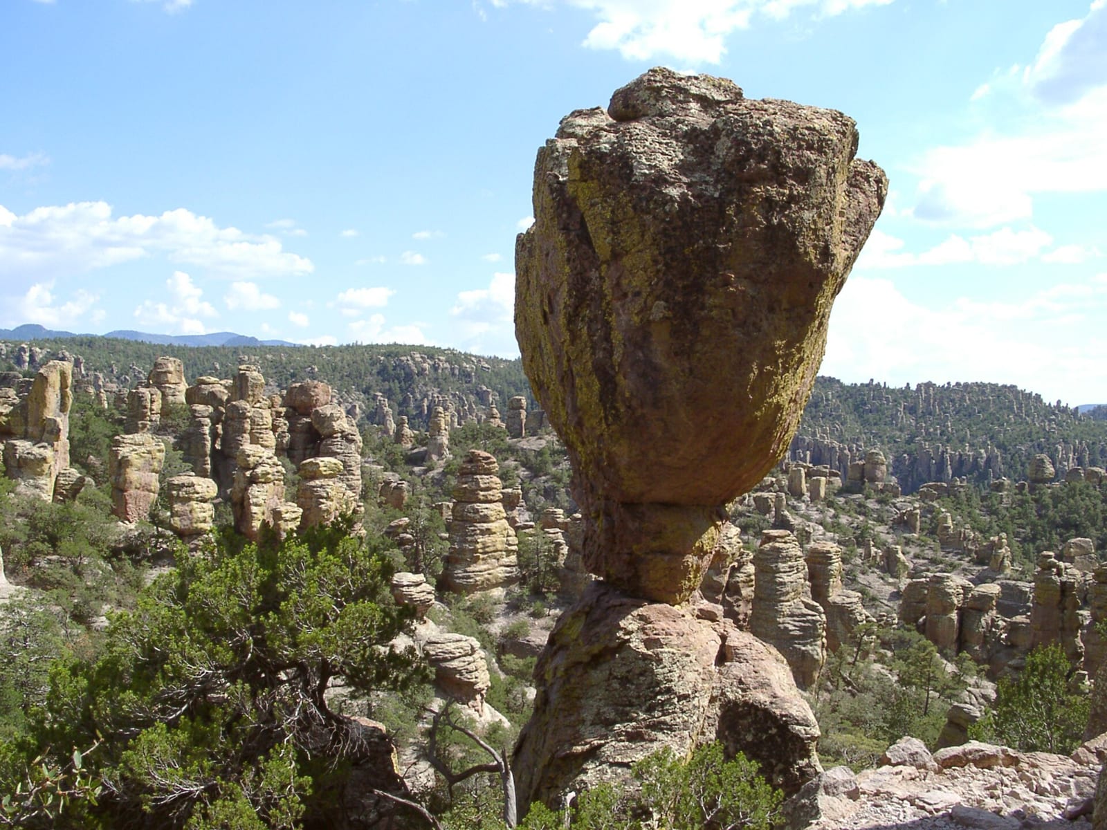
- Heart of the Rocks from Echo CanyonVia Ed Riggs to Mushroom Rock and Big Balanced Rock; do not start after 1 p.m.
- Heart of the Rocks from Visitor CenterLower Rhyolite and Sarah Deming to Heart of Rocks; hike the loop clockwise.
- Big LoopConnects upper trails including Echo Canyon and Heart of Rocks; plan a full day.
- Faraway Ranch to Visitor CenterThrough Silver Spur Meadow past Faraway Ranch historic district.
Source: nps.gov/chir/planyourvisit/upload/2026_Park_Hiking_Guide_8x14_Remediated.pdf, checked 2026-09-29.
What to see
- HighlightWonderland of RocksRhyolite pinnacles and balanced rocks along Echo Canyon and Hailstone trails.
- OverlookMassai PointEnd of the scenic drive with nature trail, picnic tables, and exhibits.
- Historic siteFaraway Ranch Historic DistrictHistoric guest ranch that helped bring Chiricahua's rock formations into public view.
- Scenic driveBonita Canyon Scenic DrivePaved out-and-back to Massai Point; vehicles over 24 ft prohibited beyond the campground.
Source: nps.gov/chir/planyourvisit/upload/2026_Park_Hiking_Guide_8x14_Remediated.pdf, checked 2026-09-29.
Public lands next to Chiricahua National Monument
- Wilderness areaChiricahua National Monument Wilderness lies inside Chiricahua National Monument.
- National forestChiricahua National Monument borders Coronado National Forest.
- Wilderness areaChiricahua Wilderness is 2.1 miles away, straight line between the two boundaries.
Measured between the units' boundaries as mapped in USGS PAD-US. Distances are straight line, not driving.
- https://www.nps.gov/state/az/index.htm (accessed 2026-09-29)
- https://www.nps.gov/chir/planyourvisit/fees.htm (accessed 2026-09-29)
- https://www.nps.gov/chir/planyourvisit/pets.htm (accessed 2026-09-28)
- https://www.nps.gov/chir/planyourvisit/basicinfo.htm (accessed 2026-09-28)
- https://www.nps.gov/chir/planyourvisit/hours.htm (accessed 2026-09-29)
- https://www.nps.gov/chir/chir_linked_data.json (accessed 2026-09-29)
- https://www.nps.gov/chir/planyourvisit/upload/2026_Park_Hiking_Guide_8x14_Remediated.pdf (accessed 2026-09-29)
- https://www.nps.gov/chir/learn/kidsyouth/daytrip.htm (accessed 2026-09-29)
- https://www.nps.gov/chir/planyourvisit/hiking.htm (accessed 2026-09-29)
- https://www.nps.gov/chir/planyourvisit/bonita-canyon-campground.htm (accessed 2026-09-29)
- https://www.recreation.gov/camping/campgrounds/250901 (accessed 2026-09-29)
- https://www.nps.gov/chir/planyourvisit/scenic-drive.htm (accessed 2026-09-29)
- https://www.nps.gov/chir/planyourvisit/directions.htm (accessed 2026-09-29)