Grand Canyon National Park
Grand Canyon National Park is a national park in Coconino County, Arizona. Entrance is $35 per vehicle, good for 7 days. It is open 24 hours a day, year-round. It has 3 developed campgrounds, from $30 a night.
Check current closures and fire restrictions for Grand Canyon National Park on the managing agency's own page.
Grand Canyon National Park map
Grand Canyon National Park boundary from USGS PAD-US or the managing agency, simplified for display. Not for navigation or legal boundaries.
Fire restrictions
No fire restriction recorded for this unit as of Sept. 30, 2026. Restrictions change with the season, so check the current orders below before you go.
Common questions
- Entrance costs $35 per vehicle, $30 per motorcycle, and $20 per person on foot or bicycle, each valid 7 days. An annual pass for Grand Canyon National Park costs $70. Interagency (America the Beautiful) passes are accepted. The park takes no cash: pay by card or buy a pass online.
- Yes. Grand Canyon National Park is open 24 hours a day, year-round.
- Yes. Grand Canyon National Park has 3 developed campgrounds. Sites cost $30 a night. Campsites must be reserved ahead, up to 180 days in advance. Mather, Desert View, and North Rim via Recreation.gov up to 6 months ahead; Mather also has some first-come sites (as of September 29, 2026). Park Service sites have no hookups (a concessioner RV park has them); showers available. 1 campground stays open year-round. Camping outside campgrounds is not allowed.
- A backcountry permit is required for every overnight trip in Grand Canyon National Park. Permits are issued by reservation.
- No. Launching, landing or operating a drone is not allowed in Grand Canyon National Park.
Fees, passes, and hours
Entrance costs $35 per vehicle, $30 per motorcycle, and $20 per person on foot or bicycle, each valid 7 days. An annual pass for Grand Canyon National Park costs $70. Interagency (America the Beautiful) passes are accepted. The park takes no cash: pay by card or buy a pass online.
Grand Canyon National Park is open 24 hours a day, year-round.
Sources: nps.gov/grca/planyourvisit/fees, checked 2026-09-28; nps.gov/grca/planyourvisit/basicinfo, checked 2026-09-29.
Entrances and visitor centers
- Grand Canyon Visitor CenterVisitor center, year-round: 8 a.m. to 4 p.m.
- Verkamp's Visitor CenterVisitor center, year-round: 8 a.m. to 8 p.m.
Source: nps.gov/grca/planyourvisit/visitorcenters, checked 2026-09-29.
Camping in Grand Canyon National Park
Grand Canyon National Park has 3 developed campgrounds. Sites cost $30 a night. Campsites must be reserved ahead, up to 180 days in advance. Mather, Desert View, and North Rim via Recreation.gov up to 6 months ahead; Mather also has some first-come sites (as of September 29, 2026). Park Service sites have no hookups (a concessioner RV park has them); showers available. 1 campground stays open year-round. Camping outside campgrounds is not allowed.
Source: nps.gov/grca/planyourvisit/camping, checked 2026-09-29.
Backcountry permits
A backcountry permit is required for every overnight trip in Grand Canyon National Park. Permits are issued by reservation.
How to get a backcountry permit for Grand Canyon National Park
Source: nps.gov/grca/planyourvisit/backcountry-permit, checked 2026-09-29.
Pets
They are allowed on trails.
Source: nps.gov/grca/planyourvisit/pets, checked 2026-09-28.
Scenic drives
- Desert View Drive23 mi, pavedOpen: Year-round for private vehicles
- Hermit Road7 mi, paved, vehicles over 22 ft not allowed on part of itOpen: Private vehicles Dec-Feb only; shuttle March 1-November 30
Source: nps.gov/grca/planyourvisit/desert-view-drive, checked 2026-09-29.
Getting there
- Nearest town: Tusayan, AZ
- Main access road: paved
- Reachable by public transit.
- Limited cell service
- South Rim open year-round; North Rim seasonal May 15-October 15. (as of 2026-09-29)
Source: nps.gov/grca/planyourvisit/basicinfo, checked 2026-09-29.
Trails
- Bright Angel TrailSouth Rim corridor trail; day hikes up to 12 miles round trip.
- South Kaibab TrailSteep corridor trail; day hikes up to 6 miles round trip; little shade.
- Hermit Trail to Santa Maria SpringUnmaintained steep trail west of Hermits Rest; treat spring water.
- Grandview Trail to Horseshoe MesaVery steep unmaintained trail from Grandview Point on Desert View Drive.
- Cape Royal TrailFlat paved North Rim walk to canyon views and Angels Window.
- Cliff Springs TrailForested ravine hike near Cape Royal; do not drink the spring.
- Point Imperial TrailEasy North Rim walk through 2000 Outlet Fire area to the park boundary.
- Cape Final TrailTwo-mile walk each way from a dirt parking area to Cape Final views.
Source: nps.gov/grca/planyourvisit/day-hiking, checked 2026-09-29.
What to see
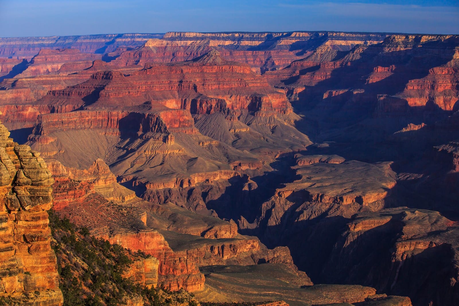
- CanyonGrand CanyonMile-deep canyon of the Colorado River averaging about 10 miles rim to rim.
- Historic siteDesert View WatchtowerHistoric tower at Desert View Point with wide Colorado River views.
- Historic siteTusayan PuebloRemains of a small Ancestral Puebloan village on Desert View Drive.
- Scenic driveDesert View Drive23-mile South Rim drive with developed viewpoints open to private vehicles.
- Scenic driveHermit Road7-mile rim road to Hermits Rest; shuttle-only March through November.
Source: nps.gov/grca/planyourvisit/desert-view-drive, checked 2026-09-29.
Public lands next to Grand Canyon National Park
- BLM unitGrand Canyon National Park borders Baaj Nwaavjo I'tah Kukveni - Ancestral Footprints of the Grand Canyon, a BLM unit.
- National Park Service unitGrand Canyon National Park borders Glen Canyon National Recreation Area.
- BLM unitGrand Canyon National Park borders Grand Canyon-Parashant National Monument.
- National forestGrand Canyon National Park borders Kaibab National Forest.
- Wilderness areaGrand Canyon National Park borders Kanab Creek Wilderness.
- National Park Service unitGrand Canyon National Park borders Lake Mead National Recreation Area.
- Wilderness areaGrand Canyon National Park borders Mount Logan Wilderness.
- Wilderness areaGrand Canyon National Park borders Saddle Mountain Wilderness.
Measured between the units' boundaries as mapped in USGS PAD-US. Distances are straight line, not driving.
- https://www.nps.gov/state/az/index.htm (accessed 2026-09-29)
- https://www.nps.gov/grca/planyourvisit/fees.htm (accessed 2026-09-28)
- https://www.nps.gov/grca/planyourvisit/pets.htm (accessed 2026-09-28)
- https://www.nps.gov/grca/planyourvisit/basicinfo.htm (accessed 2026-09-29)
- https://www.nps.gov/grca/learn/management/statistics.htm (accessed 2026-09-29)
- https://www.nps.gov/grca/faqs.htm (accessed 2026-09-29)
- https://www.nps.gov/grca/planyourvisit/day-hiking.htm (accessed 2026-09-29)
- https://www.nps.gov/grca/planyourvisit/camping.htm (accessed 2026-09-29)
- https://www.nps.gov/grca/learn/news/campground-fee-rate-change-may-2025.htm (accessed 2026-09-29)
- https://www.nps.gov/grca/planyourvisit/visitorcenters.htm (accessed 2026-09-29)
- https://www.nps.gov/grca/planyourvisit/desert-view-drive.htm (accessed 2026-09-29)
- https://www.nps.gov/grca/planyourvisit/hermit-road.htm (accessed 2026-09-29)
- https://www.nps.gov/grca/planyourvisit/backcountry-permit.htm (accessed 2026-09-29)
- https://www.nps.gov/grca/learn/management/lawsandpolicies.htm (accessed 2026-09-29)
- https://www.nps.gov/grca/planyourvisit/directions.htm (accessed 2026-09-29)