Arrastra Mountain Wilderness
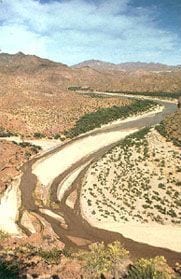
Arrastra Mountain Wilderness is a 129,800-acre wilderness area in Mohave County, Arizona. It rises from about 1,156 to 4,787 ft. The nearest town is Alamo Lake, 3.5 miles away in a straight line.
Arrastra Mountain Wilderness map
Arrastra Mountain Wilderness boundary from USGS PAD-US or the managing agency, simplified for display. Not for navigation or legal boundaries.
Fire restrictions
Fire restriction orders for this unit are not tracked here yet. Restrictions change with the season, so check the current orders before any campfire, stove or target shooting.
Common questions
- Alamo Lake, AZ is the nearest town, 3.5 miles in a straight line from the boundary (not a driving distance).
- The highest ground in Arrastra Mountain Wilderness is about 4,787 ft, and its lowest about 1,156 ft (USGS 3DEP elevation model). Its highest named summit is Arrastra Mountain, about 4,787 ft.
Who manages Arrastra Mountain Wilderness
| Agency | Acres | Permit | Group size | Stay limit | Office |
|---|---|---|---|---|---|
| BLM | 129,800 | Not on record | Not on record | Not on record | Bureau of Land Management, Kingman Field Office, 928-718-3700 |
Getting to Arrastra Mountain Wilderness
- Alamo Lake, AZ is the nearest town, 3.5 miles in a straight line from the boundary (not a driving distance). (US Census places, accessed 2026-09-29)
- Access roads named on the area's wilderness.net page: Interstate 40, Alamo Road, US Highway 93, Mile Road, Signal Road.
Position, roads and vehicle notes: wilderness.net page for Arrastra Mountain Wilderness, accessed 2026-09-29. Roads and conditions change; check with the managing office before driving in.
Named summits, canyons, and springs in Arrastra Mountain Wilderness
- Arrastra Mountain summit
- McLendon Peak summit
- Ives Peak summit
- Hackberry Canyon canyon
- Peoples Canyon canyon
- Arrowhead Spring spring
- Burro Spring spring
Features whose official location is inside the boundary, from the USGS Geographic Names Information System, accessed 2026-09-29. Summit elevations measured on the USGS 3DEP elevation model, which can read a few feet under a surveyed summit height.
Public lands next to Arrastra Mountain Wilderness
- Wilderness areaArrastra Mountain Wilderness borders Tres Alamos Wilderness.
Measured between the units' boundaries as mapped in USGS PAD-US. Distances are straight line, not driving.
Other wilderness areas in Arizona
- https://wilderness.net/visit-wilderness/?ID=18 (accessed 2026-09-29)
- https://prd-tnm.s3.amazonaws.com/StagedProducts/Elevation/1/TIFF/current/n35w114/USGS_1_n35w114.tif (accessed 2026-09-29)
- https://prd-tnm.s3.amazonaws.com/StagedProducts/GeographicNames/DomesticNames/DomesticNames_AZ_Text.zip (accessed 2026-09-29)
- https://www2.census.gov/geo/docs/maps-data/data/gazetteer/2025_Gazetteer/2025_gaz_place_04.txt (accessed 2026-09-29)