Muir Woods National Monument
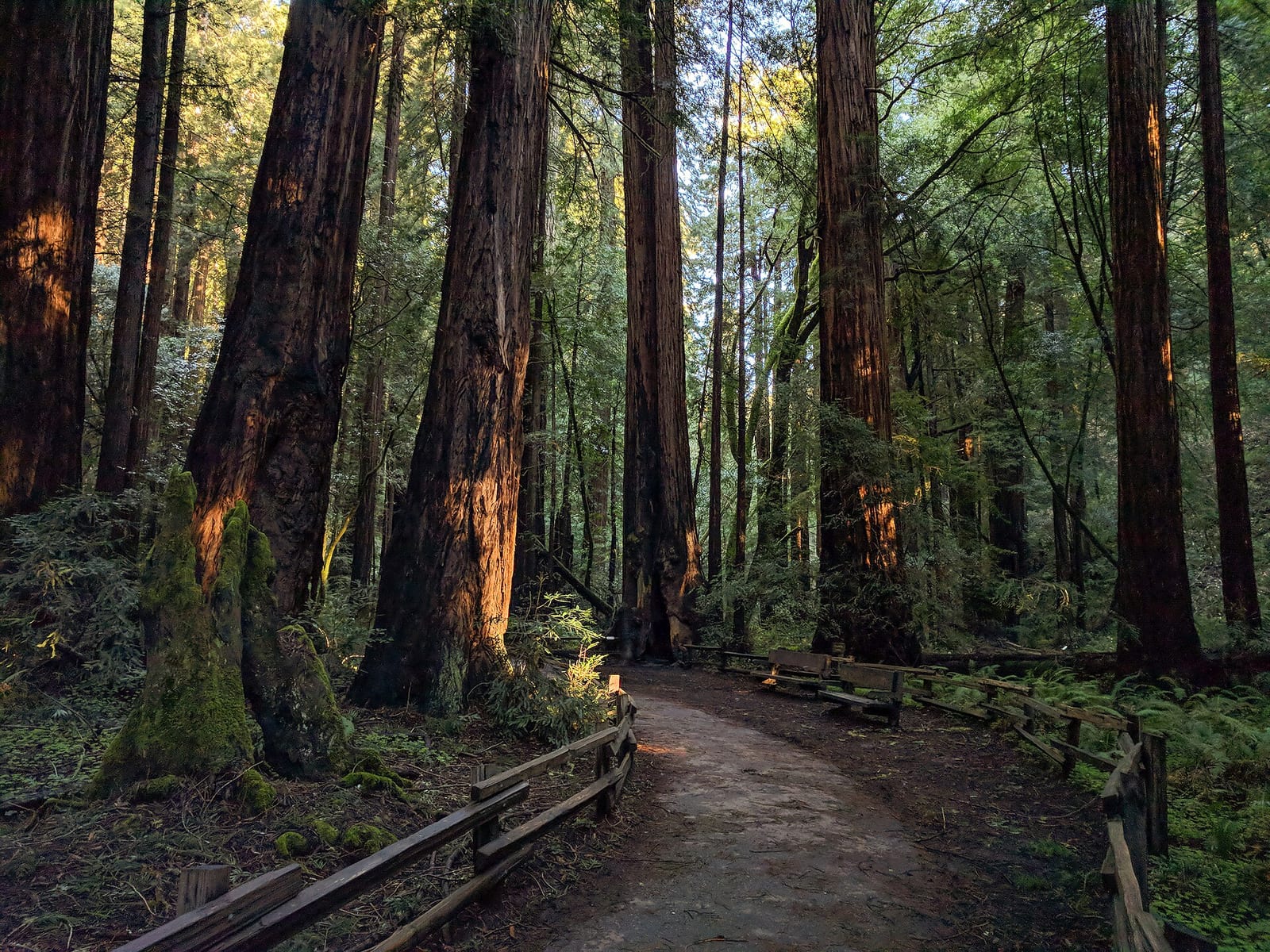
Muir Woods National Monument is a national monument run by the National Park Service in Marin County, California. It is open 24 hours a day, year-round.
Check current closures and fire restrictions for Muir Woods National Monument on the managing agency's own page.
Muir Woods National Monument map
Muir Woods National Monument boundary from USGS PAD-US or the managing agency, simplified for display. Not for navigation or legal boundaries.
Fire restrictions
No fire restriction recorded for this unit as of Sept. 30, 2026. Restrictions change with the season, so check the current orders below before you go.
Common questions
- Entrance costs $15 per person on foot or bicycle. An annual pass for Muir Woods National Monument costs $45. Interagency (America the Beautiful) passes are accepted. A reservation is needed to enter.
- Yes. Muir Woods National Monument is open 24 hours a day, year-round.
- No. Muir Woods National Monument has no developed campground. Camping is not allowed in Muir Woods; designated campgrounds are in surrounding Mount Tamalpais State Park (as of September 29, 2026). Camping outside campgrounds is not allowed.
Fees, passes, and hours
Entrance costs $15 per person on foot or bicycle. An annual pass for Muir Woods National Monument costs $45. Interagency (America the Beautiful) passes are accepted. A reservation is needed to enter.
Muir Woods National Monument is open 24 hours a day, year-round.
Source: nps.gov/muwo/planyourvisit/fees, checked 2026-09-29.
Entrances and visitor centers
- Muir Woods Visitor CenterVisitor center, year-round: 8 a.m. to 4:30 p.m.Visitor center, year-round: 8 a.m. to 4:30 p.m.Visitor center, year-round: 8 a.m. to 4:30 p.m.4155612850
Source: nps.gov/muwo/muwo_linked_data.json, checked 2026-09-28.
Camping in Muir Woods National Monument
Muir Woods National Monument has no developed campground. Camping is not allowed in Muir Woods; designated campgrounds are in surrounding Mount Tamalpais State Park (as of September 29, 2026). Camping outside campgrounds is not allowed.
Source: nps.gov/muwo/planyourvisit/hike, checked 2026-09-29.
Trails
- Main Trail: Bridge 2 loopAccessible boardwalk along Redwood Creek through old-growth redwoods.
- Main Trail: Bridge 3 loopStroller and wheelchair accessible; west side between bridges 2-3 is more uneven.
- Main Trail: Bridge 4 loopLongest flat Main Trail option; turn around at Bridge 4 to stay on accessible surfaces.
- Fern Creek to Camp Alice Eastwood LoopFern Creek canyon past Cathedral Grove; about 340 ft elevation gain.
- Canopy View-Lost Trail-Fern Creek LoopSteeper hike into quieter forest; about 530 ft elevation gain.
Source: nps.gov/muwo/planyourvisit/hike, checked 2026-09-29.
What to see
- GroveCathedral GroveDesignated quiet space of old-growth coast redwoods along the Main Trail.
- GroveFounders GroveNamed for people instrumental in preserving the forest; near the Canopy View trailhead.
Source: nps.gov/muwo/planyourvisit/hike, checked 2026-09-29.
Public lands next to Muir Woods National Monument
- State parkMuir Woods National Monument borders Mount Tamalpais State Park.
- National Park Service unitGolden Gate National Recreation Area is 0.2 miles away, straight line between the two boundaries.
- BLM unitCalifornia Coastal National Monument is 2.2 miles away, straight line between the two boundaries.
Measured between the units' boundaries as mapped in USGS PAD-US. Distances are straight line, not driving.
- https://www.nps.gov/state/ca/index.htm (accessed 2026-09-29)
- https://www.nps.gov/muwo/planyourvisit/fees.htm (accessed 2026-09-29)
- https://www.nps.gov/muwo/planyourvisit/basicinfo.htm (accessed 2026-09-29)
- https://www.nps.gov/muwo/planyourvisit/directions.htm (accessed 2026-09-28)
- https://www.nps.gov/muwo/muwo_linked_data.json (accessed 2026-09-28)
- https://www.nps.gov/muwo/planyourvisit/hike.htm (accessed 2026-09-29)
- https://www.nps.gov/muwo/learn/education/education-request-form.htm (accessed 2026-09-29)