Point Reyes National Seashore
Point Reyes National Seashore is a national seashore run by the National Park Service in Marin County, California. There is no entrance fee. It is open during posted hours, year-round; see the visitor center hours below.
Current notices posted by the managing agency. Checked Sept. 30, 2026.
- Closure: North Beach and North Beach Road temporarily closed to visitors. Point Reyes National Seashore has temporarily closed North Beach after a fishing vessel ran aground early on Friday, August 21st. No injuries or fuel leaks have been reported, and the National Park Service is coordinating with the U.S. Coast Guard, NOAA and Marin County Fire as the Coast Guard works to secure a contractor to remove fuel from the vessel. Visitors are asked to stay clear of North Be
Check current closures and fire restrictions for Point Reyes National Seashore on the managing agency's own page.
Point Reyes National Seashore map
Point Reyes National Seashore boundary from USGS PAD-US or the managing agency, simplified for display. Not for navigation or legal boundaries.
Fire restrictions
No fire restriction recorded for this unit as of Sept. 30, 2026. Restrictions change with the season, so check the current orders below before you go.
Common questions
- Yes. Point Reyes National Seashore has no entrance fee.
- Yes. Point Reyes National Seashore is open during posted hours, year-round; see the visitor center hours below.
- Sites cost $30 a night.
Fees, passes, and hours
Point Reyes National Seashore has no entrance fee.
Point Reyes National Seashore is open during posted hours, year-round; see the visitor center hours below.
Sources: nps.gov/pore/planyourvisit/fees, checked 2026-09-28; nps.gov/pore/pore_linked_data.json, checked 2026-09-29.
Entrances and visitor centers
- Bear Valley Visitor CenterVisitor center, year-round: 9:30 a.m. to 5 p.m.Visitor center, year-round: 9:30 a.m. to 5 p.m.Visitor center, year-round: 9:30 a.m. to 5 p.m.4154645100
- Kenneth C. Patrick Visitor CenterVisitor center, year-round: 10 a.m. to 4:30 p.m.Visitor center, year-round: 9 a.m. to 5 p.m.Visitor center, year-round: 9 a.m. to 5 p.m.415-669-1250
- Point Reyes Lighthouse Visitor CenterVisitor center, year-round: 10 a.m. to 4 p.m.Visitor center, year-round: 10 a.m. to 4 p.m.Visitor center, year-round: 12 p.m. to 4 p.m.415-669-1534
Source: nps.gov/pore/pore_linked_data.json, checked 2026-09-28.
Camping in Point Reyes National Seashore
Sites cost $30 a night.
Source: nps.gov/pore/planyourvisit/camping, checked 2026-09-28.
Pets
Only some trails allow them.
Source: nps.gov/pore/planyourvisit/pets, checked 2026-09-28.
Trails
- Earthquake TrailPaved San Andreas Fault interpretive loop at Bear Valley.
- Woodpecker Nature TrailBear Valley forest and meadow nature loop.
- Kule Loklo TrailPath to a replica Coast Miwok village exhibit.
- Elephant Seal Overlook TrailShort walk from Chimney Rock parking to seal overlook.
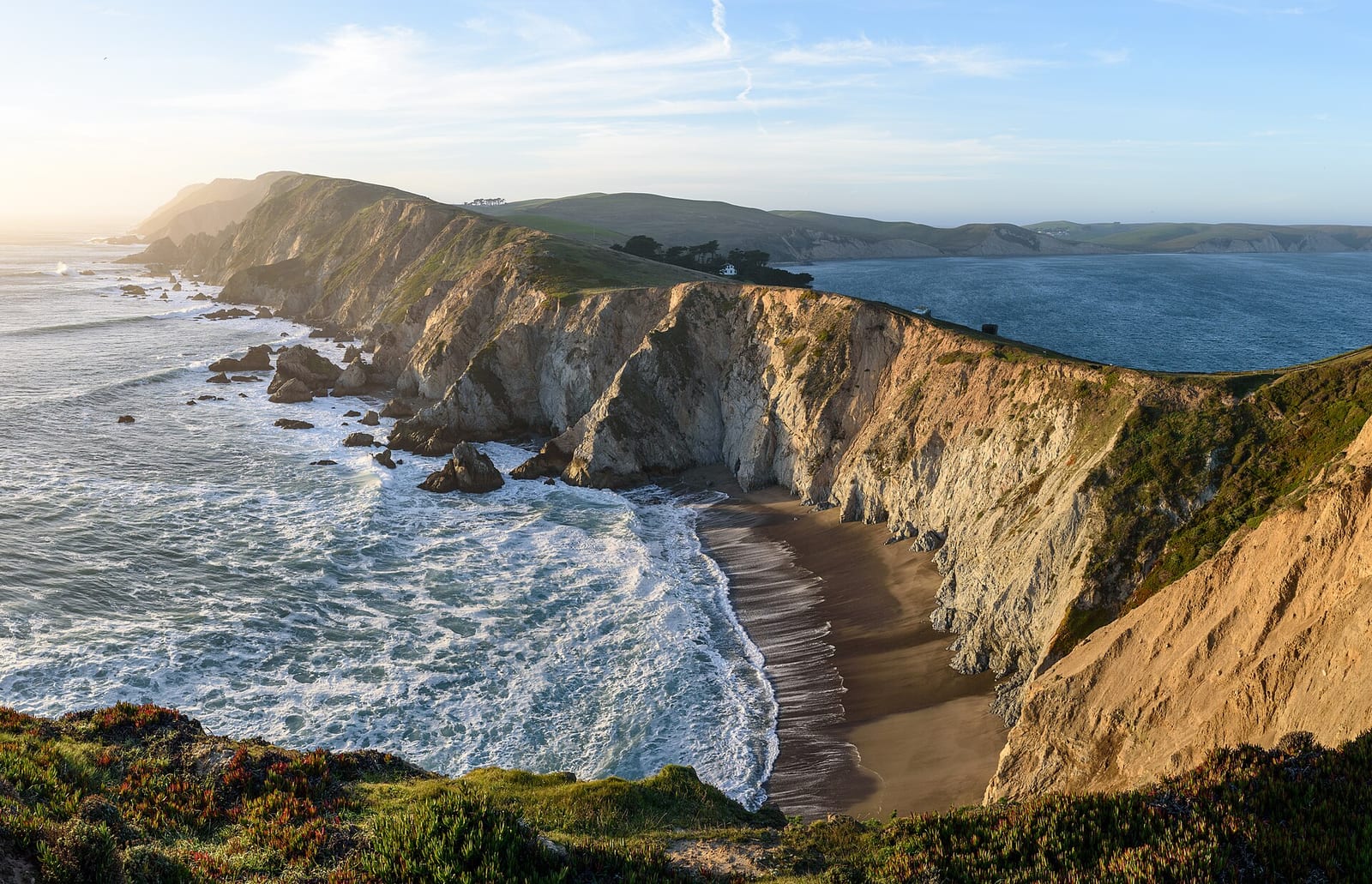
- Chimney Rock TrailCoastal headland with Drakes Bay views; whale watching seasonally.
- Abbotts Lagoon TrailEasy hike to the lagoon footbridge; dunes continue to the beach.
- Marshall Beach Trail1.2 mi one-way old ranch road to Tomales Bay beach.
- Estero Trail to Home BayGrassland hike to Home Bay footbridge for birds and rays.
- Tomales Point TrailRidge to Tomales Point; tule elk; Windy Gap turnaround is 2 mi RT.
- Alamere Falls via Coast TrailMinimum 13 mi RT to cascade onto Wildcat Beach; low tide required.
Source: nps.gov/pore/planyourvisit/hiking, checked 2026-09-29.
What to see
- Historic sitePoint Reyes LighthouseHistoric light station; stairs may close when winds exceed 40 mph.
- OverlookChimney RockHeadland overlook for whales, wildflowers, and Drakes Bay views.
- HighlightAlamere FallsTidefall cascading ~40 ft onto Wildcat Beach; long strenuous approach.
- WildlifeTule elk at Tomales PointFree-ranging tule elk often seen along the Tomales Point Trail.
- HighlightEarthquake Trail displacement fenceFence offset shows ~16 ft of 1906 San Andreas Fault movement.
Source: nps.gov/pore/planyourvisit/hiking, checked 2026-09-29.
Public lands next to Point Reyes National Seashore
- Wilderness areaPhillip Burton Wilderness lies inside Point Reyes National Seashore.
- National Park Service unitPoint Reyes National Seashore borders Golden Gate National Recreation Area.
- State parkPoint Reyes National Seashore borders Tomales Bay State Park.
- BLM unitCalifornia Coastal National Monument is 0.4 miles away, straight line between the two boundaries.
- State parkMarconi Conference Center State Historic Park is 0.7 miles away, straight line between the two boundaries.
- State parkSamuel P. Taylor State Park is 1.3 miles away, straight line between the two boundaries.
- State parkMount Tamalpais State Park is 2.6 miles away, straight line between the two boundaries.
Measured between the units' boundaries as mapped in USGS PAD-US. Distances are straight line, not driving.
- https://www.nps.gov/state/ca/index.htm (accessed 2026-09-29)
- https://www.nps.gov/pore/planyourvisit/fees.htm (accessed 2026-09-28)
- https://www.nps.gov/pore/planyourvisit/pets.htm (accessed 2026-09-28)
- https://www.nps.gov/pore/planyourvisit/basicinfo.htm (accessed 2026-09-28)
- https://www.nps.gov/pore/planyourvisit/camping.htm (accessed 2026-09-28)
- https://www.nps.gov/pore/pore_linked_data.json (accessed 2026-09-28)
- https://www.nps.gov/pore/planyourvisit/hiking.htm (accessed 2026-09-29)
- https://www.nps.gov/thingstodo/walk-the-earthquake-trail.htm (accessed 2026-09-29)
- https://www.nps.gov/thingstodo/hike-the-chimney-rock-trail.htm (accessed 2026-09-29)
- https://www.nps.gov/thingstodo/hike-the-tomales-point-trail.htm (accessed 2026-09-29)
- https://www.nps.gov/thingstodo/hike-to-alamere-falls.htm (accessed 2026-09-29)
- https://www.nps.gov/pore/planyourvisit/one-hour-hikes.htm (accessed 2026-09-29)
- https://www.nps.gov/pore/planyourvisit/placestogo.htm (accessed 2026-09-29)
- https://www.nps.gov/pore/planyourvisit/things2do.htm (accessed 2026-09-29)