San Joaquin River National Wildlife Refuge
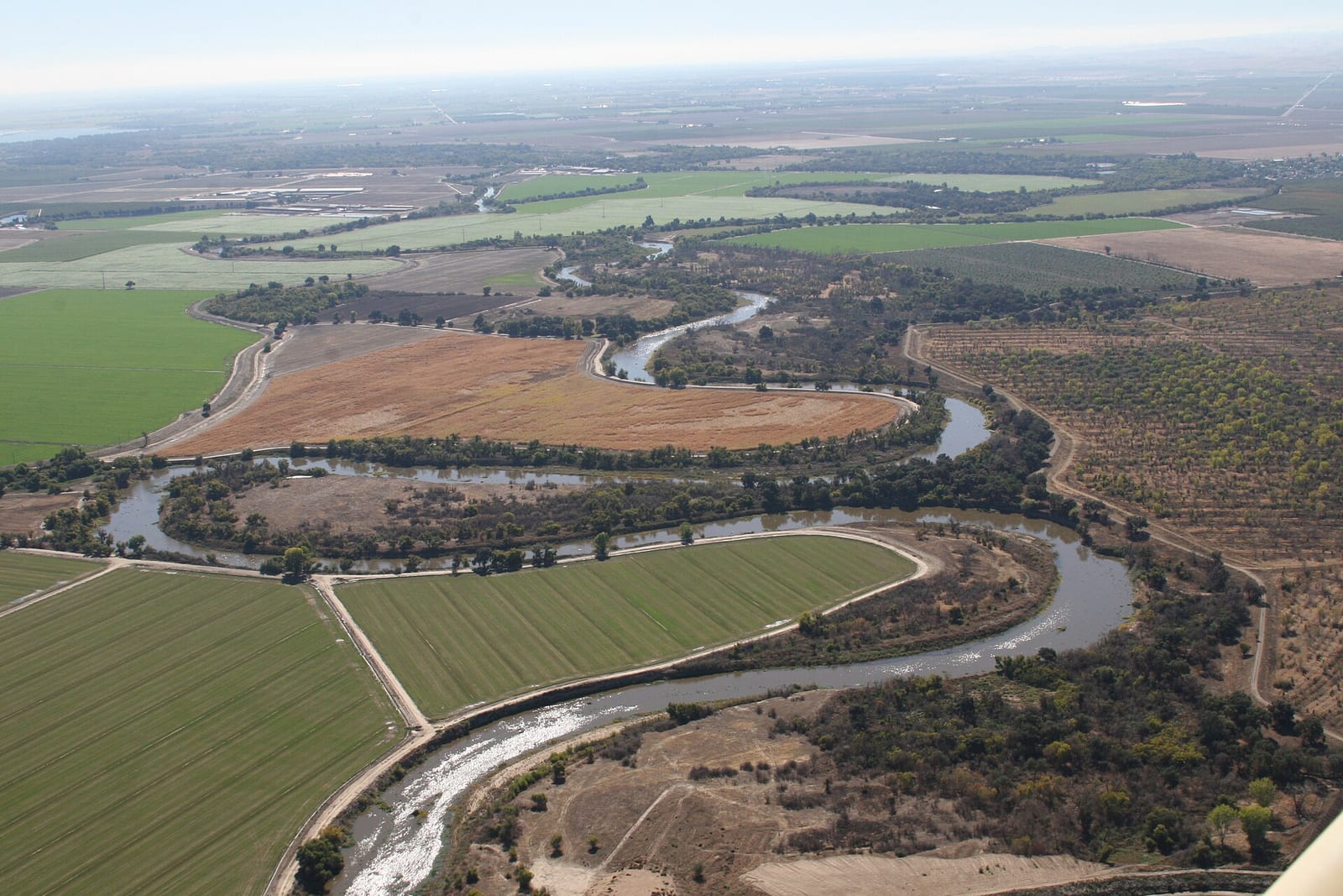
San Joaquin River National Wildlife Refuge is a national wildlife refuge in Stanislaus County, California run by the U.S. Fish and Wildlife Service. There is no entrance fee. It is open from sunrise to sunset, year-round.
Check current closures and fire restrictions for San Joaquin River National Wildlife Refuge on the managing agency's own page.
San Joaquin River National Wildlife Refuge map
San Joaquin River National Wildlife Refuge boundary from USGS PAD-US or the managing agency, simplified for display. Not for navigation or legal boundaries.
Fire restrictions
Fire restrictions change with the season and can start or lift within days. Check the current orders for this area before any campfire, stove, smoking, target shooting or off-road driving.
Common questions
- Yes. San Joaquin River National Wildlife Refuge is open from sunrise to sunset, year-round.
- No. There is no entrance fee at San Joaquin River National Wildlife Refuge.
- Yes. Hunting is allowed on San Joaquin River National Wildlife Refuge for waterfowl and upland game birds. Where, per the refuge: Follow refuge-specific regulations and state seasons; see refuge hunting page. Seasons, limits and methods are set by the refuge regulation and Nevada Department of Wildlife rules, which change every year: read them before you go.
- Yes. Fishing is allowed on San Joaquin River National Wildlife Refuge with a Nevada fishing license. Where, per the refuge: Allowed only in designated areas per refuge fishing page.
- Yes. Dogs are allowed on San Joaquin River National Wildlife Refuge on a leash. Leashed pets allowed on signed trails and roads unless posted otherwise.
- Yes. The refuge has an auto tour route, Pelican auto tour route (4 miles).
Hours, fees, and visitor center
San Joaquin River National Wildlife Refuge is open from sunrise to sunset, year-round.
There is no entrance fee at San Joaquin River National Wildlife Refuge.
What visitors do here: an auto tour route, birding, environmental education, fishing, hiking, hunting, photography, wildlife viewing.
Source: fws.gov/refuge/san-joaquin-river/visit-us, checked 2026-09-29.
Auto tour route
- Pelican auto tour route4 miPick up brochure at Pelican trailhead kiosk on Dairy Road
Source: fws.gov/refuge/san-joaquin-river/visit-us, checked 2026-09-29.
Wildlife
- BirdSandhill crane
- BirdMigratory birds
Hunting
Hunting is allowed on San Joaquin River National Wildlife Refuge for waterfowl and upland game birds. Where, per the refuge: Follow refuge-specific regulations and state seasons; see refuge hunting page. Seasons, limits and methods are set by the refuge regulation and Nevada Department of Wildlife rules, which change every year: read them before you go.
Hunting rules for San Joaquin River National Wildlife Refuge
Source: fws.gov/refuge/san-joaquin-river/visit-us, checked 2026-09-29.
Fishing and boating
Fishing is allowed on San Joaquin River National Wildlife Refuge with a Nevada fishing license. Where, per the refuge: Allowed only in designated areas per refuge fishing page.
Source: fws.gov/refuge/san-joaquin-river/visit-us, checked 2026-09-29.
Pets
Dogs are allowed on San Joaquin River National Wildlife Refuge on a leash. Leashed pets allowed on signed trails and roads unless posted otherwise.
Source: fws.gov/refuge/san-joaquin-river/visit-us, checked 2026-09-29.
Trails
- Beckwith Wildlife Observation Area TrailSigned refuge trail; see refuge map for closures
- Pelican Nature TrailSigned refuge trail; see refuge map for closures
Source: fws.gov/refuge/san-joaquin-river/visit-us, checked 2026-09-29.
Places on the refuge
- PlacePelican trailhead kioskAuto tour and nature trail maps at the Dairy Road trailhead
Source: fws.gov/refuge/san-joaquin-river/visit-us, checked 2026-09-29.
Public lands next to San Joaquin River National Wildlife Refuge
- State parkSan Joaquin River National Wildlife Refuge borders Caswell Memorial State Park.
Measured between the units' boundaries as mapped in USGS PAD-US. Distances are straight line, not driving.
- https://www.fws.gov/refuge/san-joaquin-river (accessed 2026-09-29)
- https://www.recreation.gov/camping/gateways/3941 (accessed 2026-09-29)
- https://www.fws.gov/refuge/san-joaquin-river/visit-us (accessed 2026-09-29)