Muddy Mountains Wilderness
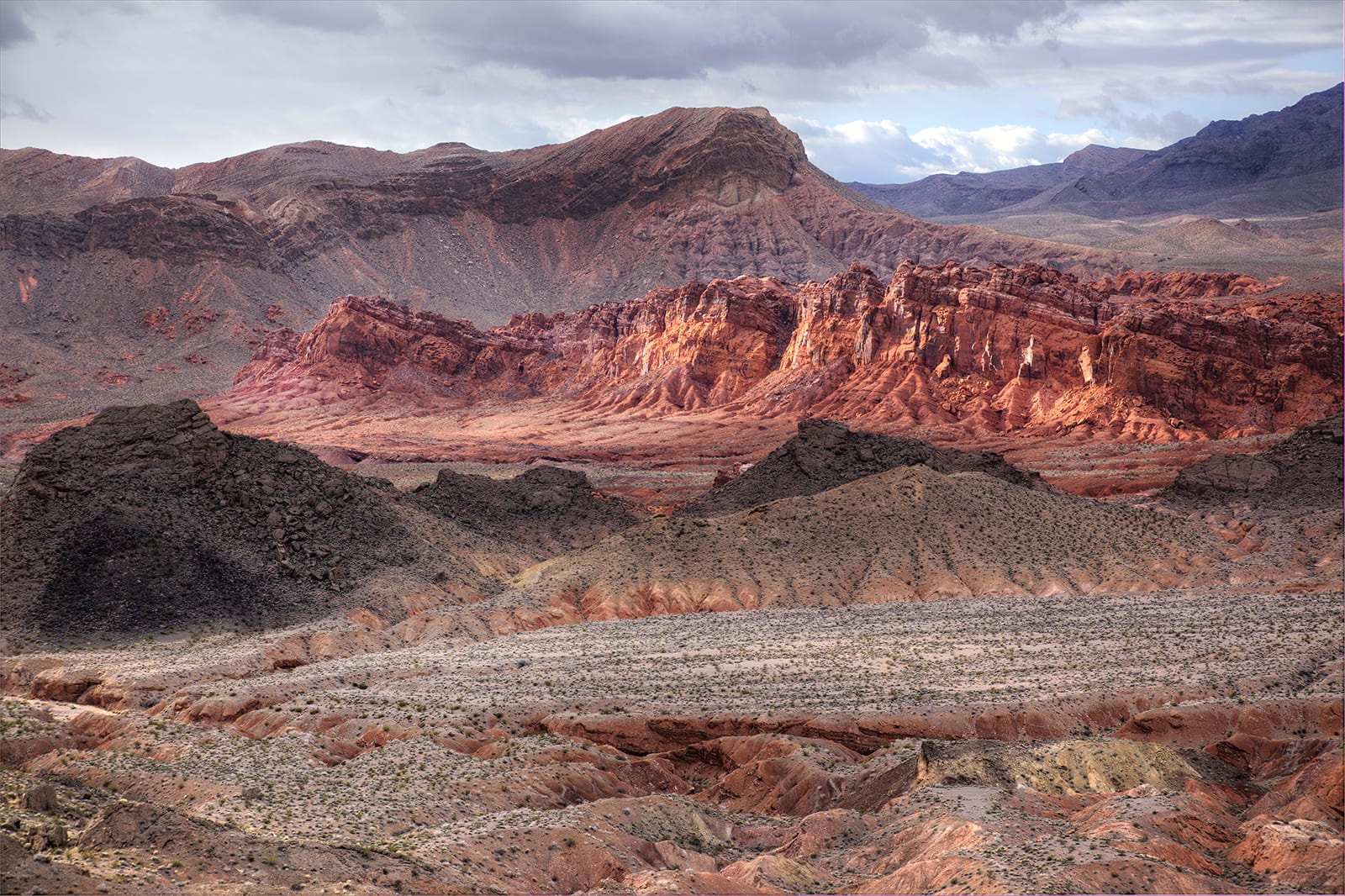
Muddy Mountains Wilderness is a 48,154-acre wilderness area in Clark County, Nevada. It rises from about 1,700 to 5,418 ft. The nearest town is Sunrise Manor, 13.9 miles away in a straight line.
Muddy Mountains Wilderness map
Muddy Mountains Wilderness boundary from USGS PAD-US or the managing agency, simplified for display. Not for navigation or legal boundaries.
Fire restrictions
5 fire restriction orders are recorded for this unit as of Sept. 30, 2026. Each links the signed order.
- NPS Lake Mead National Recreation Area Fire Restrictions Rescissions Effective Oct. 1, 2026. Applies to the part of this wilderness managed by Lake Mead National Recreation Area (National Park Service). Listed under Southern Nevada on Nevada Fire Info. The signed order states the exact area, what it prohibits, and exemptions.
- NPS Lake Mead National Recreation Area Fire Restrictions Effective May 29, 2026. Applies to the part of this wilderness managed by Lake Mead National Recreation Area (National Park Service). Listed under Southern Nevada on Nevada Fire Info. The signed order states the exact area, what it prohibits, and exemptions.
- BLM Southern Nevada District Fire Prevention Order Effective May 26, 2026. Applies to the part of this wilderness managed by the Las Vegas Field Office (BLM Southern Nevada District). Listed under Southern Nevada on Nevada Fire Info. The signed order states the exact area, what it prohibits, and exemptions.
- BLM Southern Nevada Year-Round Fire Restrictions Applies to the part of this wilderness managed by the Las Vegas Field Office (BLM Southern Nevada District). Year-round order. Listed under Southern Nevada on Nevada Fire Info. The signed order states the exact area, what it prohibits, and exemptions.
- BLM Nevada Prevention Order: BLM statewide restrictions Effective May 1, 2026. Applies to all BLM and Forest Service land in Nevada, which here is the part managed by the Las Vegas Field Office. Prohibited: Possessing, discharging, using or allowing the use of fireworks, pyrotechnic or incendiary devices; possessing, discharging, igniting or causing to burn; explosives or explosive material, including binary explosive targets; discharging a firearm using tracer, incendiary, or steel-component ammunition. [Use of tracer or incendiary ammunition is always prohibited on public lands]; operating or using any internal or external combustion engine without a spark arresting device properly installed, maintained and in effective working order.
Nevada Fire Info, BLM Nevada's interagency fire site, keeps the Nevada fire restrictions map and signed orders for every fire zone, and a Nevada fire map of active fires.
Common questions
- Camping in Muddy Mountains Wilderness is limited to 15 days.
- The maximum group size at Muddy Mountains Wilderness is 12.
- Campfires are allowed: Fire pan or fire blanket required; Not during regional fire restrictions.
- Sunrise Manor, NV is the nearest town, 13.9 miles in a straight line from the boundary (not a driving distance).
- The highest ground in Muddy Mountains Wilderness is about 5,418 ft, and its lowest about 1,700 ft (USGS 3DEP elevation model). Its highest named summit is Muddy Peak, about 5,322 ft.
Who manages Muddy Mountains Wilderness
| Agency | Acres | Permit | Group size | Stay limit | Office |
|---|---|---|---|---|---|
| National Park Service | 3,521 | Not on record | 12 | 15 days | Lake Mead National Recreation Area, 702-293-8990 |
| BLM | 44,633 | Not on record | 12 | 15 days | Las Vegas Field Office, 702-515-5000 |
Getting to Muddy Mountains Wilderness
- Sunrise Manor, NV is the nearest town, 13.9 miles in a straight line from the boundary (not a driving distance). (US Census places, accessed 2026-09-25)
- Access roads named on the area's wilderness.net page: Bitter Springs Backcountry Byway, Interstate 15, Northshore Road, Callville Wash Road.
- High-clearance, four-wheel-drive vehicles are recommended on the access roads.
Position, roads and vehicle notes: wilderness.net page for Muddy Mountains Wilderness, accessed 2026-09-25. Roads and conditions change; check with the managing office before driving in.
Trailheads at Muddy Mountains Wilderness
- North Bowl of Fire Trailhead (inside the boundary, 1,919 ft), at 36.2222, -114.6536 (mapped on OpenStreetMap)
- Bowl of Fire Trailhead (0.02 mi outside the boundary, 1,850 ft), at 36.2158, -114.6639 (mapped on OpenStreetMap)
- Arch (0.05 mi outside the boundary, 2,930 ft), at 36.3617, -114.7115
- Anniversary Narrows Trailhead (0.4 mi outside the boundary, 1,898 ft), at 36.2148, -114.7065 (mapped on OpenStreetMap)
Trailhead locations: BLM recreation sites layer , accessed 2026-09-25. Elevations from USGS 3DEP.
Trailheads mapped on OpenStreetMap: © OpenStreetMap contributors, available under the Open Database License , accessed 2026-09-25. The extract used here, with distances from the boundary: osm-trailheads-nv.json. Where an agency layer lists the same trailhead, the agency's point is shown instead.
Named summits, canyons, and springs in Muddy Mountains Wilderness
- Muddy Peak summit
Features whose official location is inside the boundary, from the USGS Geographic Names Information System, accessed 2026-09-25. Summit elevations measured on the USGS 3DEP elevation model, which can read a few feet under a surveyed summit height.
Public lands next to Muddy Mountains Wilderness
- National Park Service unitMuddy Mountains Wilderness borders Lake Mead National Recreation Area.
- Wilderness areaPinto Valley Wilderness is 0.3 miles away, straight line between the two boundaries.
Measured between the units' boundaries as mapped in USGS PAD-US. Distances are straight line, not driving.
Other wilderness areas in Nevada
- https://wilderness.net/visit-wilderness/?ID=400 (accessed 2026-09-25)
- https://prd-tnm.s3.amazonaws.com/StagedProducts/Elevation/1/TIFF/current/n37w115/USGS_1_n37w115.tif (accessed 2026-09-25)
- https://prd-tnm.s3.amazonaws.com/StagedProducts/GeographicNames/DomesticNames/DomesticNames_NV_Text.zip (accessed 2026-09-25)
- https://www2.census.gov/geo/docs/maps-data/data/gazetteer/2025_Gazetteer/2025_gaz_place_32.txt (accessed 2026-09-25)
- https://gis.blm.gov/arcgis/rest/services/recreation/BLM_Natl_Recs_pts/MapServer/14 (accessed 2026-09-25)
- https://www.openstreetmap.org/copyright (accessed 2026-09-25)