Natural Bridges National Monument
Natural Bridges National Monument is a national monument run by the National Park Service in San Juan County, Utah. Entrance is $20 per vehicle. It is open 24 hours a day, year-round.
Check current closures and fire restrictions for Natural Bridges National Monument on the managing agency's own page.
Natural Bridges National Monument map
Natural Bridges National Monument boundary from USGS PAD-US or the managing agency, simplified for display. Not for navigation or legal boundaries.
Fire restrictions
Fire restrictions change with the season and can start or lift within days. Check the current orders for this area before any campfire, stove, smoking, target shooting or off-road driving.
Utah Fire Info, Utah DNR's interagency fire information hub, keeps the Utah fire restrictions map and signed orders for every fire zone, and a Utah fire map of active fires.
Common questions
- Entrance costs $20 per vehicle, $15 per motorcycle, and $10 per person on foot or bicycle. Interagency (America the Beautiful) passes are accepted.
- Yes. Natural Bridges National Monument is open 24 hours a day, year-round.
Fees, passes, and hours
Entrance costs $20 per vehicle, $15 per motorcycle, and $10 per person on foot or bicycle. Interagency (America the Beautiful) passes are accepted.
Natural Bridges National Monument is open 24 hours a day, year-round.
Sources: nps.gov/nabr/planyourvisit/fees, checked 2026-09-28; nps.gov/nabr/planyourvisit/hours, checked 2026-09-28.
Trails
- Sipapu-Kachina LoopPrimitive loop past Sipapu and Kachina bridges.
- Kachina-Owachomo LoopLoop past Kachina and Owachomo bridges; pets prohibited.
Source: nps.gov/nabr/planyourvisit/hiking, checked 2026-09-29.
What to see
- ArchSipapu BridgeOne of three natural bridges in the monument.
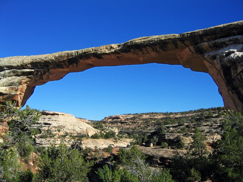
- ArchOwachomo BridgeThinnest and oldest bridge in the monument.
Source: nps.gov/nabr/planyourvisit/hiking, checked 2026-09-29.
Public lands next to Natural Bridges National Monument
- BLM unitNatural Bridges National Monument borders Bears Ears National Monument - Indian Creek Unit.
- National forestManti-La Sal National Forest is 1 mile away, straight line between the two boundaries.
Measured between the units' boundaries as mapped in USGS PAD-US. Distances are straight line, not driving.
- https://www.nps.gov/state/ut/index.htm (accessed 2026-09-29)
- https://www.nps.gov/nabr/planyourvisit/fees.htm (accessed 2026-09-28)
- https://www.nps.gov/nabr/planyourvisit/basicinfo.htm (accessed 2026-09-28)
- https://www.nps.gov/nabr/planyourvisit/hours.htm (accessed 2026-09-28)
- https://www.nps.gov/nabr/planyourvisit/hiking.htm (accessed 2026-09-29)