Yosemite National Park
Yosemite National Park is a national park in Mariposa County, California. Entrance is $35 per vehicle, good for 7 days. It is open 24 hours a day, year-round. It has 13 developed campgrounds.
Check current closures and fire restrictions for Yosemite National Park on the managing agency's own page.
Yosemite National Park map
Yosemite National Park boundary from USGS PAD-US or the managing agency, simplified for display. Not for navigation or legal boundaries.
Fire restrictions
No fire restriction recorded for this unit as of Sept. 30, 2026. Restrictions change with the season, so check the current orders below before you go.
Common questions
- Entrance costs $35 per vehicle, $30 per motorcycle, and $20 per person on foot or bicycle, each valid 7 days. An annual pass for Yosemite National Park costs $70. Interagency (America the Beautiful) passes are accepted. The park takes no cash: pay by card or buy a pass online.
- Yes. Yosemite National Park is open 24 hours a day, year-round.
- Yes. Yosemite National Park has 13 developed campgrounds. Reservations are taken in season; otherwise sites are first come, first served. All 13 campgrounds are on reservation April-October; in winter Camp 4, Wawona, and Hodgdon Meadow are first-come, first-served. Upper Pines stays on reservation year-round (as of September 29, 2026). 3 campgrounds stay open year-round. Camping outside campgrounds is not allowed.
- Pets are allowed in Yosemite National Park. They are not allowed on trails.
Fees, passes, and hours
Entrance costs $35 per vehicle, $30 per motorcycle, and $20 per person on foot or bicycle, each valid 7 days. An annual pass for Yosemite National Park costs $70. Interagency (America the Beautiful) passes are accepted. The park takes no cash: pay by card or buy a pass online.
Yosemite National Park is open 24 hours a day, year-round.
Sources: nps.gov/yose/planyourvisit/fees, checked 2026-09-29; nps.gov/yose/planyourvisit/hours, checked 2026-09-28.
Camping in Yosemite National Park
Yosemite National Park has 13 developed campgrounds. Reservations are taken in season; otherwise sites are first come, first served. All 13 campgrounds are on reservation April-October; in winter Camp 4, Wawona, and Hodgdon Meadow are first-come, first-served. Upper Pines stays on reservation year-round (as of September 29, 2026). 3 campgrounds stay open year-round. Camping outside campgrounds is not allowed.
Source: nps.gov/yose/planyourvisit/camping, checked 2026-09-29.
Pets
Pets are allowed in Yosemite National Park. They are not allowed on trails.
Source: nps.gov/yose/planyourvisit/pets, checked 2026-09-28.
Scenic drives
- Glacier Point RoadpavedOpen: Usually open May to November, depending on conditions
Source: nps.gov/yose/planyourvisit/glacierhikes, checked 2026-09-29.
Getting there
- The park warns that GPS and phone map directions can send you the wrong way: follow the park's own directions.
- Reachable by public transit.
- Tioga Road, Glacier Point Road, and Mariposa Grove Road close for winter each year. (as of 2026-09-29)
Source: nps.gov/yose/planyourvisit/directions, checked 2026-09-29.
Trails
- Bridalveil FallShort paved walk to the base of Bridalveil Fall; 80 ft elevation gain.
- Lower Yosemite FallEntire loop to the base of Lower Yosemite Fall; about 50 ft gain.
- Mirror LakeLake and back (5 mi for the entire loop); about 100 ft to the lake.
- Valley Loop TrailFull valley loop; half loop is 6.5 mi; mostly flat.
- Yosemite Falls Trail (to Columbia Rock)First section of Yosemite Falls Trail; about 1,000 ft elevation gain.
- Yosemite Falls TrailTop of Upper Yosemite Fall; about 2,700 ft elevation gain.
- Vernal Fall and Nevada FallMist Trail / John Muir routes; NPS lists 1.6-8 mi RT and 400-2,000 ft gain.
- Four Mile Trail closed part of the year Yosemite Valley to Glacier Point; about 3,200 ft elevation gain.
- Half Dome closed part of the year Cables route; 14-16.4 mi RT and about 4,800 ft gain; day-hike permit required.
- Sentinel Dome closed part of the year From Glacier Point Road; 400 ft gain to 360-degree granite dome views.
- Taft Point closed part of the year From Glacier Point Road; about 200 ft gain to cliff-edge overlooks.
Source: nps.gov/yose/planyourvisit/valleyhikes, checked 2026-09-29.
What to see
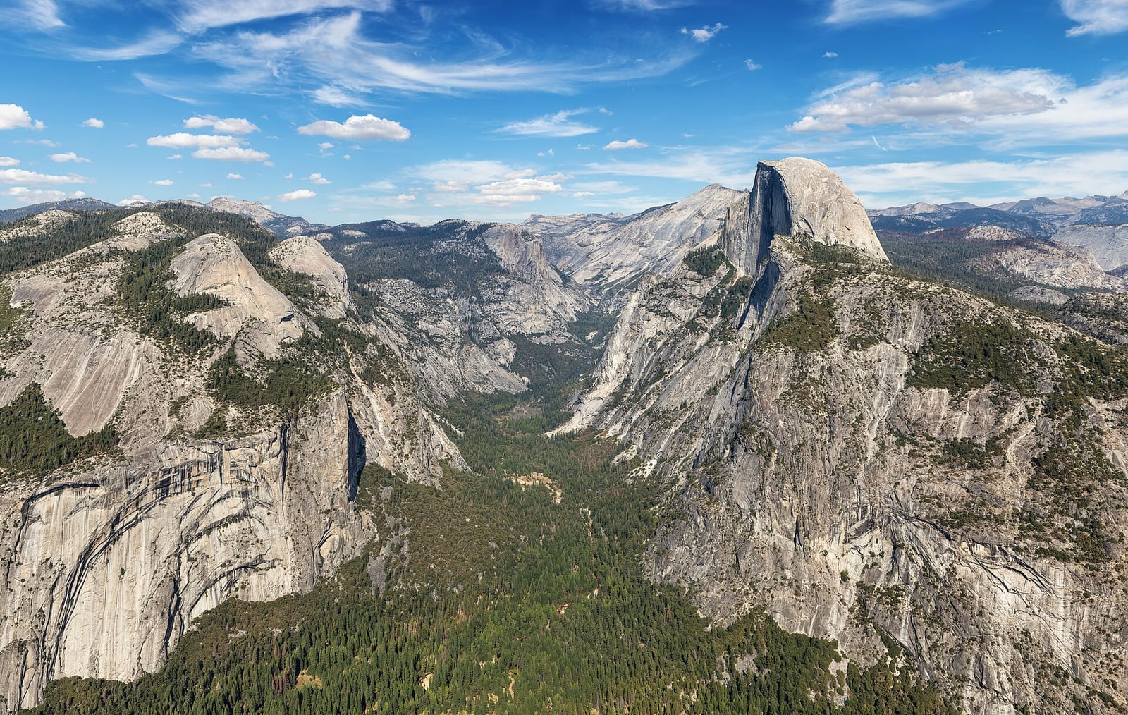
- CanyonYosemite ValleyGlacially carved valley with granite walls, waterfalls, and the Merced River.
- PeakHalf DomeIconic granite dome; cables day hike requires a permit when cables are up.
- HighlightYosemite FallsOne of North America's tallest waterfalls; Lower Fall trail is an easy valley walk.
- OverlookGlacier PointOverlook about 3,200 ft above Yosemite Valley with views of Half Dome and the high Sierra.
- GroveMariposa Grove of Giant SequoiasGiant sequoia grove reached via the Wawona area; Mariposa Grove Road closes in winter.
Source: nps.gov/yose/planyourvisit/directions, checked 2026-09-29.
Fishing and water
Tioga Lake fishing (0.7 miles outside the boundary): its fishing and stocking record on fishypedia.com.
Public lands next to Yosemite National Park
- Wilderness areaYosemite Wilderness lies inside Yosemite National Park.
- Wilderness areaYosemite National Park borders Ansel Adams Wilderness.
- Wilderness areaYosemite National Park borders Emigrant Wilderness.
- Wilderness areaYosemite National Park borders Hoover Wilderness.
- National forestYosemite National Park borders Humboldt-Toiyabe National Forest.
- National forestYosemite National Park borders Inyo National Forest.
- National forestYosemite National Park borders Sierra National Forest.
- National forestYosemite National Park borders Stanislaus National Forest.
Measured between the units' boundaries as mapped in USGS PAD-US. Distances are straight line, not driving.
- https://www.nps.gov/state/ca/index.htm (accessed 2026-09-29)
- https://www.nps.gov/yose/planyourvisit/fees.htm (accessed 2026-09-29)
- https://www.nps.gov/yose/planyourvisit/pets.htm (accessed 2026-09-28)
- https://www.nps.gov/yose/planyourvisit/hours.htm (accessed 2026-09-28)
- https://www.nps.gov/yose/planyourvisit/camping.htm (accessed 2026-09-29)
- https://www.nps.gov/yose/planyourvisit/valleyhikes.htm (accessed 2026-09-29)
- https://www.nps.gov/yose/planyourvisit/halfdome.htm (accessed 2026-09-29)
- https://www.nps.gov/yose/planyourvisit/glacierhikes.htm (accessed 2026-09-29)
- https://www.nps.gov/yose/planyourvisit/directions.htm (accessed 2026-09-29)