Indian Peaks Wilderness
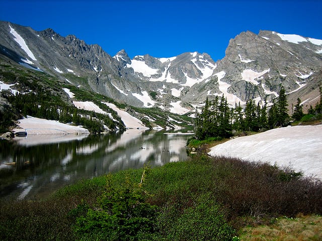
Indian Peaks Wilderness is a 77,932-acre wilderness area in Grand County, Colorado. It rises from about 8,276 to 13,491 ft. The nearest town is Eldora, 1.4 miles away in a straight line.
Indian Peaks Wilderness map
Indian Peaks Wilderness boundary from USGS PAD-US or the managing agency, simplified for display. Not for navigation or legal boundaries.
Fire restrictions
Agency fire restriction orders for this unit are not tracked here yet. Restrictions change with the season, so check the current orders before any campfire, stove or target shooting.
County and local burn bans may also apply on private, state, or county land nearby. On federal land, follow the land manager's order; off it, follow the strictest county or local rule that applies. When both touch your trip, obey both.
Common questions
- Eldora, CO is the nearest town, 1.4 miles in a straight line from the boundary (not a driving distance).
- The highest ground in Indian Peaks Wilderness is about 13,491 ft, and its lowest about 8,276 ft (USGS 3DEP elevation model). Its highest named summit is North Arapaho Peak, about 13,491 ft.
Who manages Indian Peaks Wilderness
| Agency | Acres | Permit | Group size | Stay limit | Office |
|---|---|---|---|---|---|
| National Park Service | 2,959 | Not on record | Not on record | Not on record | Not on record |
| Forest Service | 74,973 | Not on record | Not on record | Not on record | Boulder Ranger District, 303-541-2500 |
Getting to Indian Peaks Wilderness
- Eldora, CO is the nearest town, 1.4 miles in a straight line from the boundary (not a driving distance). (US Census places, accessed 2026-09-30)
Trailheads at Indian Peaks Wilderness
- Coney Flats Trailhead (inside the boundary, 9,797 ft), at 40.1303, -105.5774
- Beaver Creek (0.03 mi outside the boundary, 9,784 ft), at 40.1298, -105.5745
- Monarch Lake Trailhead (0.04 mi outside the boundary, 8,350 ft), at 40.1111, -105.7464
- Rollins Pass Trailhead (0.04 mi outside the boundary, 11,669 ft), at 39.9351, -105.6821
- Mitchell Lake Trailhead (0.05 mi outside the boundary, 10,487 ft), at 40.0831, -105.5817
- Roaring Fork Trailhead (0.07 mi outside the boundary, 8,289 ft), at 40.1294, -105.7642
- Buchanan Pass Trailhead (0.13 mi outside the boundary, 9,608 ft), at 40.1374, -105.5857
- Rainbow Lakes Trailhead (0.15 mi outside the boundary, 9,956 ft), at 40.0095, -105.5691
Trailhead locations: Forest Service recreation sites layer , accessed 2026-09-30. Elevations from USGS 3DEP.
Named summits, canyons, and springs in Indian Peaks Wilderness
- North Arapaho Peak summit
- Apache Peak summit
- Navajo Peak summit
- Hell Canyon canyon
- Betty Lake lake
Features whose official location is inside the boundary, from the USGS Geographic Names Information System, accessed 2026-09-30. Summit elevations measured on the USGS 3DEP elevation model, which can read a few feet under a surveyed summit height.
Campgrounds in and around Indian Peaks Wilderness
- Arapaho Bay camping (0.3 miles outside the boundary): its sites, fees, and reservations on campgroundsdb.com.
- Pawnee camping (0.4 miles outside the boundary): its sites, fees, and reservations on campgroundsdb.com.
Fishing and water
Monarch Lake fishing (0.2 miles outside the boundary): its fishing and stocking record on fishypedia.com.
Public lands next to Indian Peaks Wilderness
- National forestIndian Peaks Wilderness lies inside Arapaho and Roosevelt National Forests.
- National Park Service unitIndian Peaks Wilderness borders Rocky Mountain National Park.
- Wilderness areaIndian Peaks Wilderness borders Rocky Mountain National Park Wilderness.
- Wilderness areaJames Peak Wilderness is 0.1 miles away, straight line between the two boundaries.
Measured between the units' boundaries as mapped in USGS PAD-US. Distances are straight line, not driving.
Other wilderness areas in Colorado
- wilderness.net (accessed 2026-09-30)
- prd-tnm.s3.amazonaws.com (accessed 2026-09-30)
- prd-tnm.s3.amazonaws.com (accessed 2026-09-30)
- prd-tnm.s3.amazonaws.com (accessed 2026-09-30)
- www2.census.gov (accessed 2026-09-30)
- apps.fs.usda.gov (accessed 2026-09-30)
The sentences on this page are generated by software from the sourced records above, not written by hand. How this content is made.