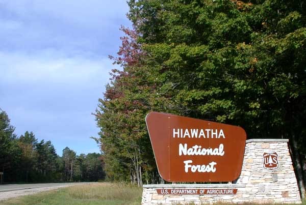
Hiawatha National Forest
Hiawatha National Forest covers 894,836 acres across Michigan. Free dispersed camping is allowed, up to 14 days.
Hiawatha National Forest map
Hiawatha National Forest boundary from USGS PAD-US or the managing agency, simplified for display. Not for navigation or legal boundaries.
Fire restrictions
Agency fire restriction orders for this unit are not tracked here yet. Restrictions change with the season, so check the current orders before any campfire, stove or target shooting.
County and local burn bans may also apply on private, state, or county land nearby. On federal land, follow the land manager's order; off it, follow the strictest county or local rule that applies. When both touch your trip, obey both.
Common questions
- Yes, dispersed camping is allowed on Hiawatha National Forest without a fee.
- Camping on Hiawatha National Forest is limited to 14 days.
- Hiawatha National Forest is managed through the USFS Ranger District.
Camping on Hiawatha National Forest
Dispersed camping allowed Stays are limited to 14 days .
32 campgrounds inside the forest boundary have their own page on campgroundsdb.com, with site counts and reservations:
- Au Train Lake Campground
- Bass Lake Campsite
- Bay Furnace Campground
- Bay View - Campground
- Bermuda Campsite
- Brevoort Lake - Campground
- Camp Seven Lake Recreation Area
- Carp River - Campground
- Channel Marker Campsite
- Chicago Lake Campsites
- Colwell Lake Recreation Area camping
- Flowing Well Recreation Area camping
- Gooseneck Lake Campsites
- Grand Island National Recreation Area camping
- Hardwood Campsite
- Island Lake Campground
- Jackpine Lake Campsites
- Juniper Flats Group Campsite
- Little Bass Lake Campsites
- Little Bay De Noc Recreation Area camping
- Loon Call Campsite
- Lyman Lake Campsites
- Monocle Lake Recreation Area camping
- Murray Bay Group Campsite
- Pete’s Lake Campground
- Preservation Point Campsite
- Shelter Ridge Campsite
- Soldier Lake Recreation Area camping
- Steuben Lake Campsites
- Swan Lake Campsites
- Three Lakes - Campground
- Widewaters Recreation Area camping
Ewing Point Campsite (right at the boundary): its sites, fees, and reservations on campgroundsdb.com.
Fire restrictions change by district and season: check the current alerts and restrictions before you go.
Hiawatha National Forest maps
- Interactive forest map from the Forest Service
Fishing and water
Fishing inside the boundary: Big Island Lake fishing , Carr Lake fishing , High Banks Lake fishing , Hike Lake fishing , Irwin Lake fishing , Mid Lake fishing , Naomikong Lake fishing , Naomikong Pond fishing , Neds Lake fishing , Rim Lake fishing , Soldier Lake fishing , Trueman Lake fishing , Twilight Lake fishing , Walker Lake fishing , with stocking records and species on fishypedia.com.
- Banana Lake fishing (right at the boundary): its fishing and stocking record on fishypedia.com.
- Petes Lake fishing (right at the boundary): its fishing and stocking record on fishypedia.com.
- Norway Lake fishing (right at the boundary): its fishing and stocking record on fishypedia.com.
- Rock Lake fishing (right at the boundary): its fishing and stocking record on fishypedia.com.
- Square Lake fishing (right at the boundary): its fishing and stocking record on fishypedia.com.
Public lands next to Hiawatha National Forest
- Wilderness areaDelirium Wilderness lies inside Hiawatha National Forest.
- Wilderness areaHorseshoe Bay Wilderness lies inside Hiawatha National Forest.
- Wilderness areaMackinac Wilderness lies inside Hiawatha National Forest.
- Wilderness areaRound Island Wilderness lies inside Hiawatha National Forest.
- Wilderness area Most of Big Island Lake Wilderness lies inside Hiawatha National Forest.
- Wilderness area Most of Rock River Canyon Wilderness lies inside Hiawatha National Forest.
- State parkHiawatha National Forest borders Palms Book State Park.
- State parkHiawatha National Forest borders Tahquamenon Falls State Park.
Measured between the units' boundaries as mapped in USGS PAD-US. Distances are straight line, not driving.
- geo.dot.gov (accessed 2026-09-30)
- www2.census.gov (accessed 2026-09-30)
- en.wikipedia.org (accessed 2026-09-30)
- fs.usda.gov (accessed 2026-09-30)
- fs.usda.gov (accessed 2026-09-30)
The sentences on this page are generated by software from the sourced records above, not written by hand. How this content is made.