Fire Island National Seashore
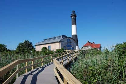
Fire Island National Seashore is a national seashore run by the National Park Service in Suffolk County, New York. There is no entrance fee.
Current notices posted by the managing agency. Checked Oct. 5, 2026.
- Closure: Main Beach Staircase at Watch Hill Closed Due to Storm Damage The beach staircase on the main dune crossing at Watch Hill is closed due to storm damage. Visitors should use the western dune crossing as an alternative. Since Sept. 30, 2026.
- Closure: Talisman-Barrett Beach Dock Closed for 2026 Season; Services Limited Due to damage from winter ice, the Talisman-Barrett Beach dock is closed. NPS staff are evaluating options for repairs. There is no timeline for restoration. Boaters should plan to anchor in the bay to access the site. Be advised that the area is extremely shallow. Restroom maintenance will be limited during this time and visitors must pack out all trash and belongings. Public use of some areas wi Since June 17, 2026.
Check current closures and fire restrictions for Fire Island National Seashore on the managing agency's own page.
Fire Island National Seashore map
Fire Island National Seashore boundary from USGS PAD-US or the managing agency, simplified for display. Not for navigation or legal boundaries.
Fire restrictions
This unit's own agency alerts list no fire restriction as of Oct. 5, 2026. We do not check a statewide fire-order feed for NY, so that is not a statement that no order exists, and not a green light for a fire. Check with the land manager and your county before you light anything.
Fees, passes, and hours
Fire Island National Seashore has no entrance fee.
Source: nps.gov, checked 2026-09-30.
Getting there
- Nearest town: Mastic Beach, 0.8 miles
Source: www2.census.gov, checked 2026-09-30.
What to see
- HighlightNational SeashoreNPS unit designation
Source: nps.gov, checked 2026-09-30.
Fishing and water
West Lake fishing (0.5 miles outside the boundary): its fishing and stocking record on fishypedia.com.
Public lands next to Fire Island National Seashore
- Wilderness area Most of Otis Pike Fire Island High Dune Wilderness lies inside Fire Island National Seashore.
- State parkFire Island National Seashore borders Robert Moses State Park – Thousand Islands.
- State parkFire Island National Seashore borders Robert Moses State Park (Long Island).
- State parkCaptree State Park is 1.5 miles away, straight line between the two boundaries.
- National wildlife refugeWertheim National Wildlife Refuge is 1.5 miles away, straight line between the two boundaries.
- State parkHeckscher State Park is 2.5 miles away, straight line between the two boundaries.
Measured between the units' boundaries as mapped in USGS PAD-US. Distances are straight line, not driving.
- nps.gov (accessed 2026-09-30)
- www2.census.gov (accessed 2026-09-30)
- nps.gov (accessed 2026-09-30)
- nps.gov (accessed 2026-09-30)
- nps.gov (accessed 2026-09-30)